
Mason ZIP Code Directory Coverage
Mason’s City ZIP and school-district map displays nine postal labels in and around the municipal area. The map is a regional orientation source, not a carrier-route directory. It identifies 45040 as Mason’s principal mailing label and places several neighboring postal geographies around the city. The inspected map does not identify a post office for each label or establish exact delivery coverage for every address, so the table preserves that limit instead of filling in unsupported postal assignments.
| ZIP Code | Areas Covered | Post Office | Notes |
|---|---|---|---|
| 45040 | Mason principal mailing label and much of the core city area | Not identified on inspected City map | Verify a delivery address; label alone does not prove city jurisdiction. |
| 45036 | Lebanon postal area at the Mason-area edge | Not identified on inspected City map | Use parcel/account data for property research. |
| 45039 | Maineville-area label near Mason | Not identified on inspected City map | The map shows regional adjacency, not complete carrier routes. |
| 45140 | Loveland-area label in the eastern or southern region | Not identified on inspected City map | Exact city-line overlap was not established from the map alone. |
| 45044 | Mason-area regional label | Not identified on inspected City map | Confirm the actual delivery address before treating it as local coverage. |
| 45069 | West Chester-area label | Not identified on inspected City map | Postal and county or city lines can diverge. |
| 45249 | Cincinnati postal geography shown on the map | Not identified on inspected City map | Its presence does not establish every Mason delivery route. |
| 45241 | Cincinnati postal geography shown on the map | Not identified on inspected City map | Check USPS, then the City or County jurisdiction field. |
| 45034 | Kings Mills-area label | Not identified on inspected City map | Pair ZIP verification with parcel and GIS review. |
This postal reference therefore begins with labels, then shifts to the exact address. It does not claim a ZIP split, realignment, PO-box-only ZIP, unique ZIP, or individual post-office assignment because the available research did not document those details for Mason.
Verify a Mason ZIP Code First
Use the USPS ZIP Code Lookup for the delivery ZIP attached to a specific address. It supports by-address, by-city-and-state, and by-ZIP checks. That is the postal step before running a Mason postal search. USPS can verify delivery geography, but the research expressly warns that a result does not establish occupancy. It also does not decide municipal jurisdiction, school district, tax district, or parcel boundary.
After the postal check, compare the address with the County Auditor property record and the GIS map. Those systems provide the parcel and jurisdiction-facing fields that a postal label does not. An old record should keep the ZIP, city name, directional street form, and subdivision or lot wording printed in the dated source. Test those elements against the parcel and legal description instead of converting them to a modern form first.
Mason ZIP Code Permit Search
Mason Accela is the documented local screen with a ZIP field. It searches City permit and property-information records by Address, Parcel Information, Owner, or Record Information. A ZIP can narrow the address-oriented permit search, but the returned item is still a permit, planning, code, or record lead. Open the result and compare its address, parcel, owner, applicant, contractor, or project role as shown before drawing a conclusion about a person or a parcel.
Monthly issued-permit reports provide a second City channel. They show permit number, type, address, applicant, description, fee, and date in published rows. When neither the report nor Accela exposes the needed City-held material, send a focused request with an address, date window, and permit number if known. Inspection is available in City buildings without charge, while copies follow the City’s stated terms.
Mason ZIP Code Fields in Accela
The Accela address form shows how its ZIP criterion fits with the rest of a Mason postal query. Required status was not stated for the individual address fields in the inspected form. A search can be as broad or narrow as the available address details allow, but the ZIP field should be treated as a postal filter rather than a parcel identifier.
| Accela field | Type | Search role | Recorded limitation |
|---|---|---|---|
| Look Up by Address | Mode selector | Opens Address, Parcel Information, Owner, or Record Information paths | Required status not stated. |
| Street Number | Text or range | Narrows a street address | Two number boxes are visible. |
| Direction, Street Name, Street Type | Dropdown and text | Builds the street portion | Options are not fully exposed in static inspection. |
| Unit Type and Unit No. | Dropdown and text | Distinguishes a unit when known | Use only as shown in the address. |
| City and State | Text | Municipal address context | Not a substitute for parcel jurisdiction. |
| Zip | Text | Postal narrowing | Useful for a permit query, not proof of a City boundary. |
| Look Up / Clear | Buttons | Runs or resets the criteria | No account requirement was stated for this lookup screen. |
Note: Record the address and permit number from any useful result, then verify the parcel through County tools before joining it to a broader record trail.
Find Mason Records After ZIP
A ZIP-wide result is not a substitute for address-level review because the County’s property interfaces are not documented as ZIP filters. The Auditor Advanced Search offers City/Village, Municipality, Street Name, Subdivision, Tax District, and other criteria, but not a ZIP criterion in the inspected list. The GIS eSearch likewise documents address, owner, account, and parcel fields rather than a ZIP filter. Use the postal check to organize the work, then move to the tools keyed to the record.
- Verify the delivery ZIP with USPS using the full address.
- Use the ZIP field in Accela if the question concerns a Mason permit, planning, or property-information record.
- Open the Auditor address or parcel result to capture the account number, parcel number, legal description, and jurisdiction-facing fields.
- Use GIS to check the mapped parcel and the County geography tied to that address.
- For a deed question, carry the parcel lead into Recorder AVA rather than relying on the ZIP as a land-record key.
Once a postal area has been narrowed to a particular address or street, the Mason street directory supplies the address-by-address workflow.
Mason ZIP Code Is Not a Parcel Key
Property research needs the key used by the record system. The Auditor parcel card can show property address, current owner, legal description, tax district, neighborhood ID, school district, sale history, Recorder Data, and a map link. GIS can return an account number, parcel number, owner, address lines, legal description, lot number, and use-code description. The Recorder’s published workflow then calls for the ten-digit parcel number from the Auditor result. A ZIP label serves none of those functions on its own.
Keep a postal ZIP, situs address, owner mailing contact, account number, parcel number, and legal description in separate notes. A situs address identifies the physical property. A mailing contact can differ from it. The parcel and legal description create the more durable bridge through county property and recorded-document systems.
When a result needs a local-government check, use the Auditor’s City/Village or Municipality criteria and the GIS map rather than a ZIP label. The property card can also show tax district, neighborhood ID, school district, and legal description. Those fields have different purposes, so agreement between two of them can support a location check without turning either field into a substitute for the other.
Separate Mason ZIP Codes From City Limits
Mason’s City map places postal ZIP labels beside city limits and school-district lines precisely because they are different systems. A 45040 mailing label, for example, is not by itself proof that a parcel lies inside the Mason corporation line. The nearby Lebanon, Maineville, Loveland, West Chester, Cincinnati, and Kings Mills labels are regional context, not a finding that every address in those areas is a Mason delivery address. USPS answers delivery; the Auditor and GIS answer the parcel and governmental-geography question.
Boundary check. Use the City ZIP and school-district map for orientation, USPS for a delivery ZIP, and Auditor or GIS records for the parcel. Each boundary answers a different question.
The City and County research did not locate a verified ZIP realignment history or an official E911-address manual. For an addressing or boundary procedure, contact Mason Engineering, Building & Planning or County GIS staff rather than inferring a rule from an older map label.
Mason ZIP Code Terms, Defined
Postal terminology helps describe a delivery address, but it should not be expanded into unsupported claims about Mason coverage or records access.
- ZIP code
- A postal delivery code used to sort mail. It does not by itself establish a city limit or parcel boundary.
- ZIP+4
- An added four-digit delivery detail used with a ZIP code. It is more specific for mail handling, not a property-record key.
- PO-box ZIP
- A ZIP associated with post-office box delivery rather than a conclusion about a street address. No Mason-specific PO-box-only ZIP was verified in the research.
- Unique ZIP
- A ZIP assigned for a single organization or delivery purpose. No Mason-specific unique ZIP was verified in the research.
- Carrier route
- A mail-delivery grouping. The inspected City map did not publish Mason carrier-route assignments.
Mason ZIP Map Boundary Limits
A Mason-area ZIP map is a regional orientation tool, not evidence that every label on it is a municipal delivery route. Postal geography, school districts, city or township lines, and parcel boundaries can all differ at the same address. The strongest local sequence is simple: check the full delivery address with USPS, inspect the parcel through Auditor and GIS, and keep the result tied to its date and record type.
The Census QuickFacts profile for Mason offers citywide context, not ZIP-delivery or parcel evidence, for a Mason postal lookup.
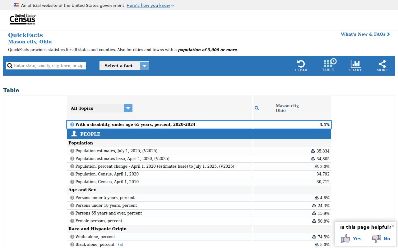
City-level figures describe Mason as a whole and should not be used to assign a postal label to an individual address.