
Trace a Mason Street by Address
The first pass through a Mason street directory is an address-to-record trail, not a name list. The Warren County Auditor supplies the current parcel record and its account, parcel, legal-description, owner, and property-address fields. Its result can then be placed in the county GIS viewer to distinguish the target parcel from nearby lots. Use the parcel lead in the Recorder AVA route for recorded instruments. A defined street-range request belongs with the Board of Elections report system, where statutory redactions and current delivery rules apply.
- Enter the address in the Auditor search. Record the property address, account number, parcel number, and legal description before moving to another system.
- Open the parcel in GIS and select the correct mapped result. Nearby parcels should be opened one at a time rather than merged by a shared street name.
- Use the Recorder’s AVA instructions with the Auditor parcel lead. Read the recorded party role and document date as stated in the instrument.
- For a street-range or household report, ask the Board of Elections which public report and format are available for the defined street and date.
- For an older address clue, use the library, historical collections, or archives to locate a dated directory, map, census, or obituary reference, then reconcile its printed form.
Mason Public Library is a useful in-person research stop for genealogy material, but it is not the custodian of county land records. A dated historical-volume lead can later be compared with the current parcel trail; the historical collections are treated in more detail in the Mason city directories.
Mason Street Directory Starts at Auditor
The Auditor’s Address mode accepts a street name with an optional street number. For a broad by-street result, leave out the number, then narrow the returned parcels carefully. The County instructs searchers to omit ordinary direction words and street types unless they are part of the street name. A state or U.S. route should be entered as ROUTE plus its number. The parcel card is a property-record anchor, not a household roster, and its data-processed timestamp is worth recording when current status matters.
| Auditor control | Input | When to use it | Mason-specific handling |
|---|---|---|---|
| Address: Street Number | Text | Exact address | Optional, so a whole street can be broadened. |
| Address: Street Name | Text | Every address query | Required; omit ordinary direction and suffix words. |
| Parcel ID | Text | Known property | Direct property key and Recorder bridge. |
| Account Number | Text | Known Auditor record | Seven-digit Auditor identifier. |
| Advanced Search | Criteria builder | Narrowing a result set | Includes municipality, street name, subdivision, tax district, sale fields, and more. |
The Auditor address-search screen shows the address entry route used for a Mason street directory query.
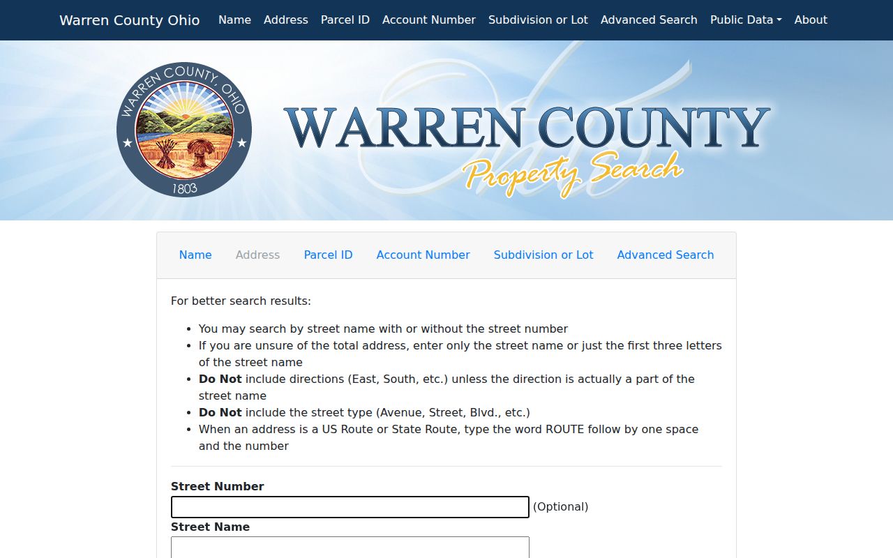
Its optional number field is why one street name can produce a broader, reviewable parcel set.
Map Mason Street Parcels
County Online Mapping adds the location check that a text result cannot provide. Its Auditor configuration offers account, address, owner, and parcel searches, plus an address-point route that requires street number, street name, and street type. Address and owner queries use contains matching, so partial wording can return more than one parcel. The results show account number, parcel number, owner, address lines, legal description, lot number, and use-code description, and each result has a direct property-summary link.
A point, line, extent, circle, or polygon can be used for graphical selection. The map also exposes a buffer with feet, miles, or meters and relationship choices such as “entirely contained in” and “intersected by.” Those tools locate parcels for review. They do not turn map proximity into proof about a household.
The Warren County parcel map is the map view used to verify the place behind a Mason street directory result.

Open the linked Auditor summary for every selected parcel before relying on its displayed attributes.
Carry a Mason Address Into AVA
The Recorder’s process begins with the Auditor record. Its instructions say to obtain the ten-digit parcel number from an Auditor name or address result, then use that parcel number in AVA for the strongest search path. The Auditor card also offers sales-history and Recorder Data tabs, while the parcel’s legal description helps test whether consecutive documents refer to the same land. All deeds are reported online and indexed through 1797, and most documents were described as available online as of April 20, 2016.
For a backward conveyance, open the current acquisition, note the seller and the legal description, then look for that prior party in the earlier role. A recorded party is evidence of the document role, not automatic proof of present residence. When an image, notation, or index entry cannot be resolved online, the Recorder counter at 406 Justice Drive in Lebanon and its phone line, 513-695-1382, are the documented fallback. The office says documents can be purchased at the counter.
Note: Keep the Recorder book or document detail with the parcel and legal-description notes so the next search can be repeated.
Mason Street Permit Leads
Mason’s Accela property-information screen is a useful address-side lead when a visible change needs a dated City record. It announces Address, Parcel Information, Owner, and Record Information routes. The address form includes street number, direction, name, type, unit, city, state, and ZIP fields. Its result is a permit or planning lead, not a statement that every person tied to the address lived there. For a current project, retain the permit number and use it to ask the City for a specific underlying file if necessary.
The City’s monthly issued-permit reports are often faster to scan than a broad request. Their published rows identify permit number, type, address, applicant, description, fee, and issue date. The applicant is a filing contact, not an occupancy claim. The City’s records channel is the fallback for a described City-held file that is not available in Accela or the monthly archive.
The Mason Accela lookup shows the address-oriented permit search used alongside the street directory.
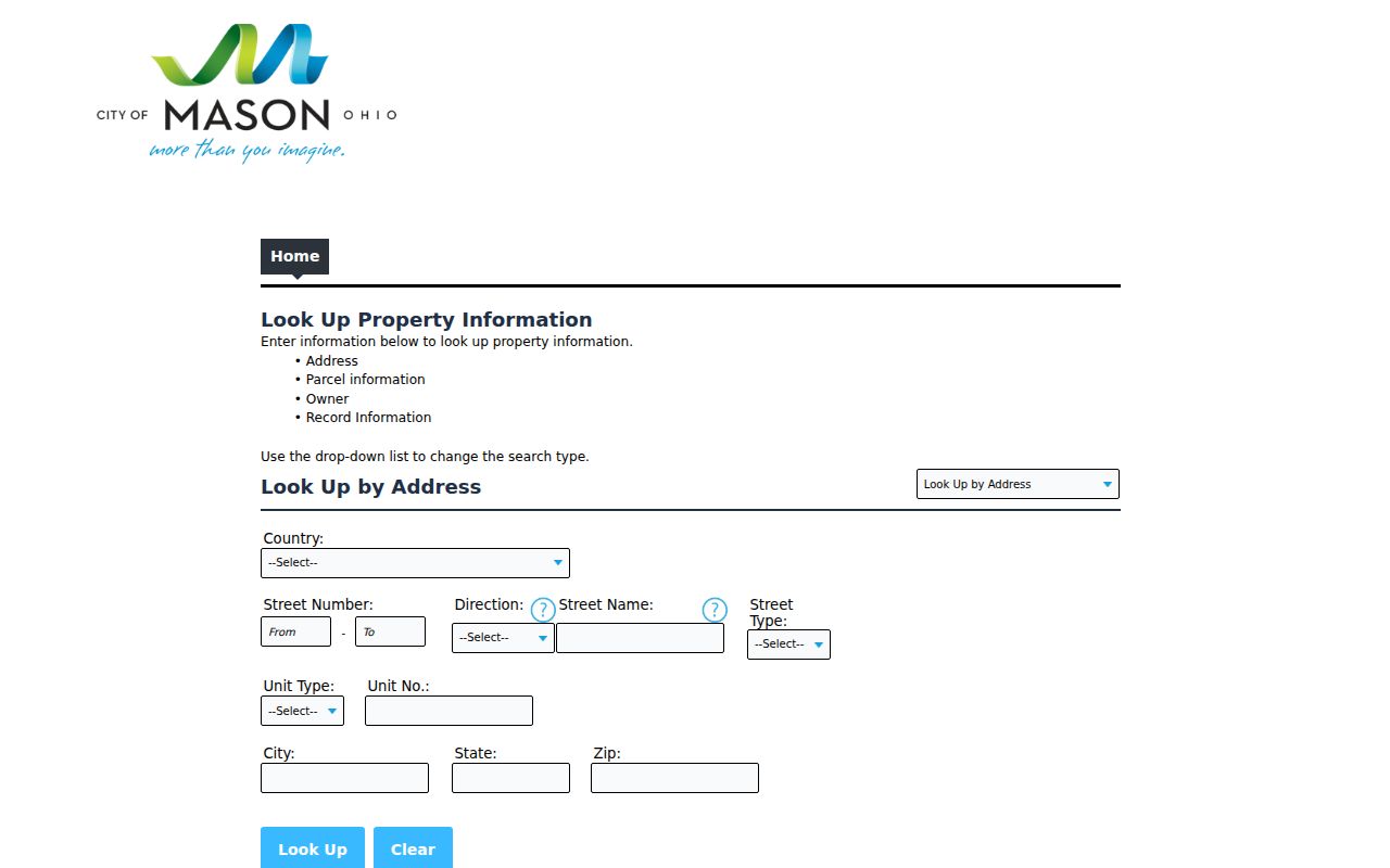
The form’s parcel and address paths help connect a City project lead to the county parcel record.
The Mason monthly permit-report archive provides the dated issued-report series.
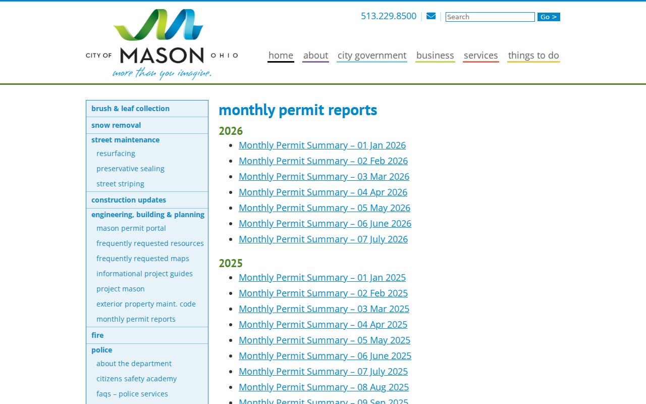
A report row can narrow the requested date range and identify a permit number for a later City records request.
The City’s building and planning documents page identifies the municipal record channel behind these address-linked materials.
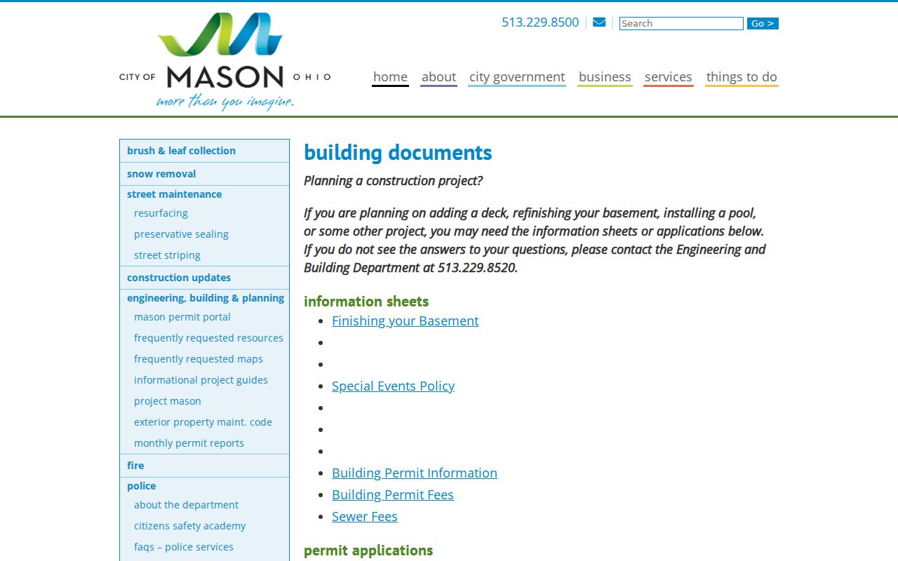
Use the precise address, date window, and permit number when requesting an item that is not shown online.
For a City-held item beyond the public display, the Mason records channel accepts a written request, and the optional request form permits inspection, pickup, or mailed copies. The City says the form is not mandatory; a requester may also call 513-229-8500. Keep the request narrow by address, date range, and record type.
Mason Street Keys, Defined
Several address terms appear across the Mason street directory chain. Keeping them separate prevents a tax contact, a parcel key, and an old directory clue from being treated as the same fact.
- Parcel
- A defined piece of land in the county property system, identified by a parcel number and linked to its mapped geometry.
- Situs address
- The physical property address shown for the parcel. It identifies the site and can differ from an owner mailing contact.
- Legal description
- The lot, subdivision, or other land-description wording that connects the Auditor record to a recorded instrument or plat.
- Account number
- The seven-digit Auditor identifier, distinct from the Recorder’s preferred ten-digit parcel key.
- Criss-cross directory
- A directory organized by address rather than name. No verified Mason-wide year run was located, so confirm a volume’s title and date before relying on it.
Compare Mason Street Record Layers
No one address-keyed source answers every Mason street question. The useful record is the one whose field matches the question: parcel ownership, mapped land, a recorded instrument, a permit, a Board report, or a dated historical clue. Each also has a separate counter or request fallback when the public screen is too thin.
| Address layer | Custodian | What it can establish | Fallback channel |
|---|---|---|---|
| Current parcel roll | Warren County Auditor | Owner of record, situs, parcel/account, legal description, tax and sales links | Real Estate office and public-data modes |
| GIS parcel map | Warren County GIS / Engineer | Parcel geometry, nearby lots, address lines, lot and use-code details | Map or data request, online or in person |
| Recorded instruments | Warren County Recorder | Parties, deed trail, legal-description and parcel leads | Recorder counter or phone help for copies and problem results |
| Permit and planning leads | Mason Engineering, Building & Planning | Project address, permit number, applicant, description, fee, and date | Monthly archive, Accela, then a focused City request |
| Street-range voter reports | Warren County Board of Elections | Available walking, household, district, or street-range reports | Defined public-record request subject to statutory exclusions |
| Historic address clue | Library, WCGS, archives, historical collections | Dated directory, map, census, or obituary context | In-person collection and reading-room research |
The parcel number ties the current roll to AVA. The account number keeps the Auditor and GIS results together. A street name can lead to several parcels and is therefore a weaker key until the number, parcel, or legal description has been checked. Historic materials should keep their original street, city, directional, and date form before being compared with modern data.
Mason Street-Range Voter Reports
The public individual voter lookup is a name form, not a street browser. Warren County’s separate report menu is the documented route for Walking List, Voter by Household, Street Range Reporting, district, precinct, election, and participation-report categories. Ask the Board for the report type, street range, date or version, field set, and requested format. That makes the request reviewable and leaves redaction decisions with the custodian.
Ohio law makes registration forms and the statewide voter database public while excluding listed identifiers and protected records. A nonmatch should not be treated as proof that a person is absent from the county. Spelling, former address information, list maintenance, or confidential status can affect what is returned.
The Warren County Board of Elections reports menu is the official street-report entry point for the Mason street directory workflow.
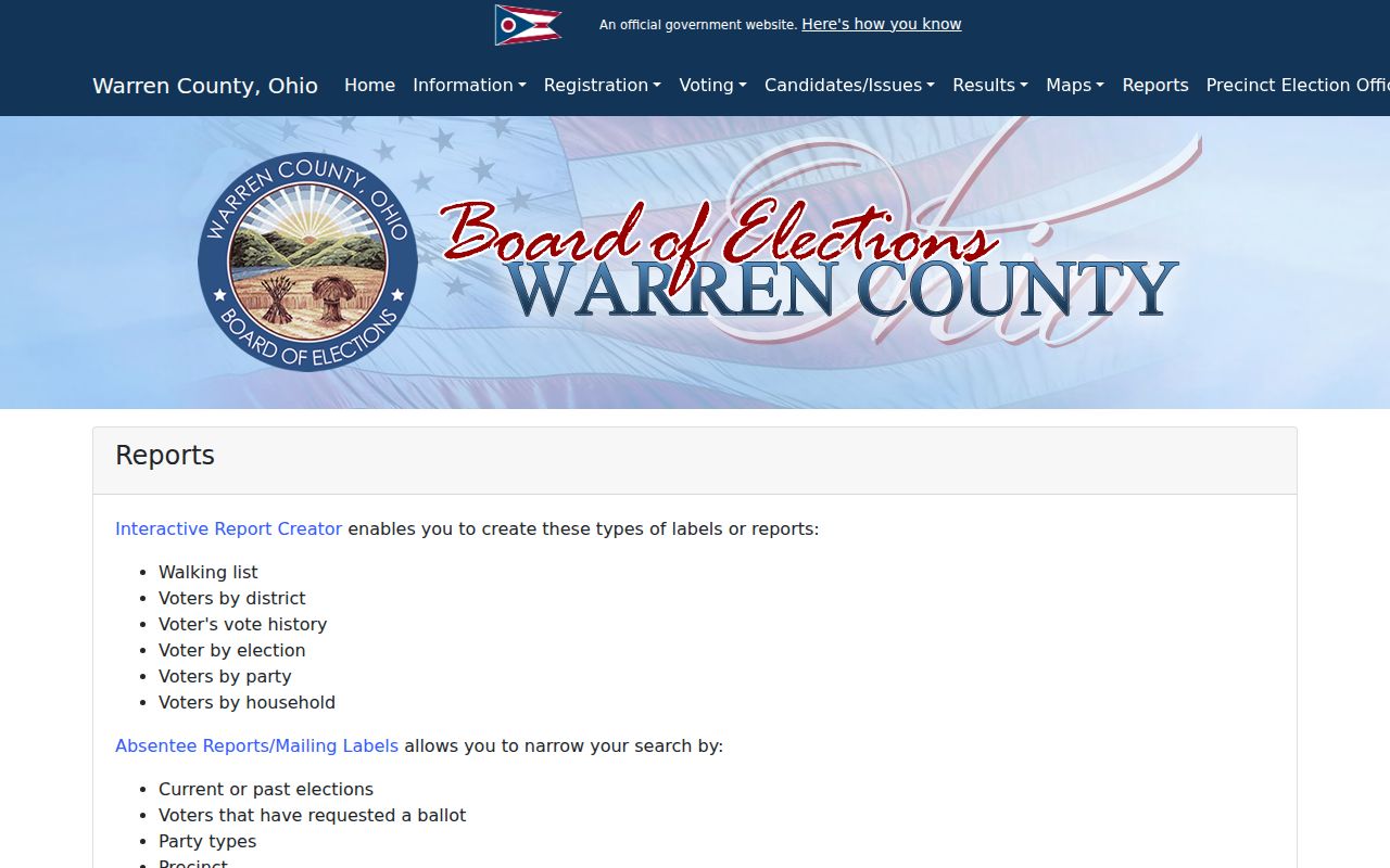
The menu shows that street-range work is a report request path, distinct from an individual name lookup.
Mason Street History Uses Old Names
Older address work needs the place name and street form printed at the time. The settlement was platted as Palmira in 1815 and became Mason in 1835. The Mason Historical Society also describes the older road now known as Route 42 and the later east-west alignment of Main Street. Search an old document under both Mason and Palmira or Palmyra when appropriate, and retain E/W or N/S directional wording rather than silently modernizing it.
The verified historic warning is not a citywide renumbering date. No authoritative Mason-wide renumbering record was found in the research. The documented checks are the Palmira name, the Main Street and Route 42 alignment, and the 1898, 1911, and 1946 Mason Sanborn editions. A date, legal description, and mapped range are stronger than a modern-looking street label alone.
Note: When the online search and a dated document conflict, ask the archives or collection holder about the original address form before joining the records.
Mason Street Directory Result Limits
A property or parcel result does not create a complete list of people connected with a Mason address. It documents its own owner, property-address, tax, parcel, and related fields. An owner mailing contact can differ from the situs address, and an owner-of-record field does not establish every occupant. Permit applicant and contractor fields likewise describe filing roles, not a complete occupancy history. Vehicle personal information has separate protection under the federal Driver’s Privacy Protection Act.
Lawful use. Use Mason address records for personal, lawful research and honor confidential voter and Safe at Home protections. Do not use a street search to stalk, harass, intimidate, or harm anyone.
For a protected or inaccurate official record, contact the custodian that created it. The Recorder, the City records channel, and the Board of Elections each handle different record types, and a public-record request cannot reopen material made confidential by law.